
Post Category : Archaeonerdism Glossary Method & Theory
Ground Penetrating Radar

By Corey Cookson on February 18, 2019
Ground-Penetrating Radar (GPR) is the process of sending radiowaves through the ground. As these radiowaves pass through the ground, any change in the subsurface materials will cause some energy to be reflected back to towards the surface while the remaining energy continues deeper. This information is recorded by a receiver which records the time it takes the wave to travel from the source, reflect off the buried object or disturbance, and travel back to the surface. The receiver converts this signal into a depth for the disturbance or object under the ground.
The ability to map and record information below the earth’s surface without excavating is a valuable tool to an archaeologist. The excavation of archaeological sites is a destructive process, so having a non-invasive way to analyze and interpret sites is sometimes necessary. This is particularly important when dealing with sensitive cultural remains and unmarked graves.
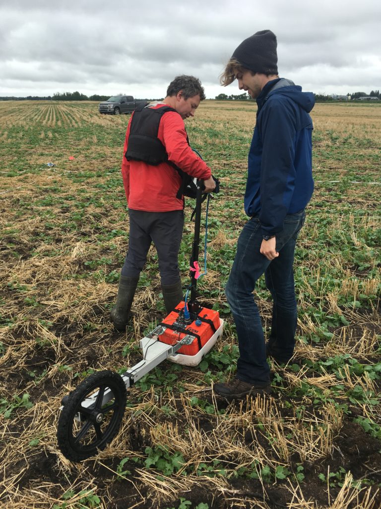
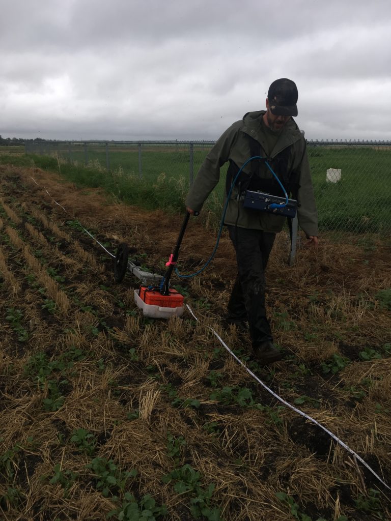
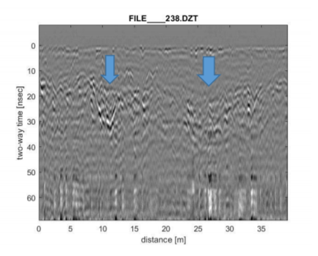
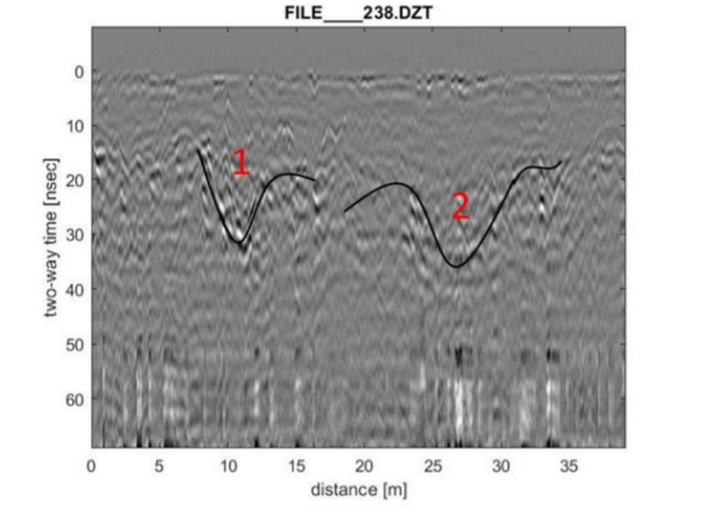
As part of an Archaeological Society of Alberta project, Tree Time Services Archaeologists, Corey Cookson and Brian Leslie, and University of Alberta Graduate Student, Liam Wadsworth, completed a GPR scan of an area identified by a local community as having possible unmarked graves. The team spent the afternoon surveying a grid to identify possible grave-shaped anomalies. The data was analyzed and the GPR scans revealed several clear grave-shaped anomalies 1.5 m beneath the surface. Some of the grave-shafts were narrow and may have contained a single individual (Figure 3, #1), while others were wider and may represent a burial pit with multiple individuals (Figure 3 #2, at least 5 m wide). This larger internment may have been the result of mass burial. It was speculated that these graves were dug around the time of the First World War and the Spanish Flu pandemic.
Related Posts
By Corey Cookson
October 17, 2023
International Archaeology Day
What is it? International Archaeology Day is a celebration of Archaeology and it’s contributions to society! International Archaeology Day annually falls on the third Saturday of October (October 21st), and was first celebrated in 2011. The day was originally designed on a national level to help promote public participation and awareness of the important contributions
Keep Reading
By Braedy Chapman
July 2, 2023
Top sites of 2022, BC edition
Field operations in British columbia 2022 marked Ember Archaeology’s first year of significant field operations in British Columbia. Our BC crews conducted a number of sizable wildfire-related projects for the BC Ministry of Forests over the course of the season, ultimately surveying hundreds of kilometers of constructed fireguards and fuel reduction developments. These were nearly
Keep Reading
By Megan Williams

June 1, 2023
The Quarry of the Ancestors
Alberta Oil sands The Alberta oil sands has seen it’s fair share of media attention over the last few decades! Unfortunately, most of it has not been positive… In this blog, we are going to discuss an amazing archaeological discovery from the Alberta oil sands, and how these findings have shaped our knowledge about prehistory
Keep Reading